Coltan-Cassiterite Project - Rwanda
About Rwanda
Rwanda is a landlocked country situated in East Africa, with a population of approximately 14.8 million. Its capital and largest city is Kigali. Traditionally, the Rwandan economy has been heavily based on agriculture, particularly the cultivation of coffee, tea, and food crops. However, the country is rapidly modernizing its framework to transition from traditional practices toward a services and technology-driven hub.
Rwanda is renowned for its mineral wealth, particularly as a leading global source of coltan (tantalum-niobium) and cassiterite (tin). The mining industry of Rwanda is centered around extensive mineralized pegmatite and quartz vein belts distributed across various districts. Mining potential is heavily renowned in critical and strategic minerals (the 3Ts: tin, tantalum, and tungsten), gold, emerging lithium exploration, and precious gemstones.
Rweru Mining Block
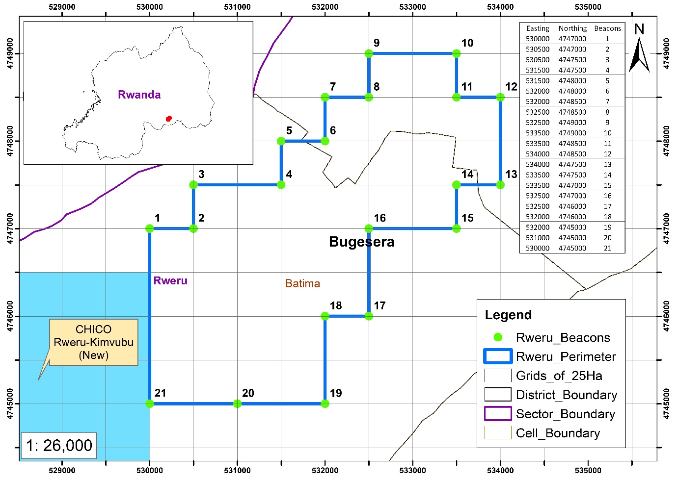
The Rweru block is located within Batima and Nkanga Cells of Rweru Sector, in Bugesera District, Eastern Province of Rwanda, spanning over an area of 875 hectares.
The site is highly accessible via the national road network, particularly the Kigali–Nyamata–Nemba corridor (NR5) and the Rusumo–Ngoma–Nyanza route (NR6), which connect Bugesera District to Kigali and onward to regional trade corridors linking Tanzania and other East African countries. The area is situated near Lake Rweru on the east and Lake Gaharwa on the west, along with a network of seasonal streams and minor drainage channels that govern local surface water flow.
Project History
The Rweru Block, covering an area of 875 hectares, was previously mined by ROKA, a German Company, until 2013. Mining operations stopped about 12 years ago.
The main artisanal mining area is located near Gasororo 1 village, where extensive pegmatite mining activity has historically taken place. About 30 vertical artisanal shafts ranging from 10 to 50 meters deep are present, with the mined pegmatite materials dumped near the shafts. Coltan and cassiterite are associated with these pegmatites and were historically recovered here by manual sluicing of the ore.
Geological Context
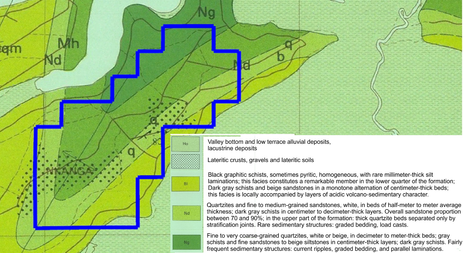
The geology of the Rweru mining block is characterized by Meso-Proterozoic metasedimentary formations intruded by granitic bodies, creating a highly favorable environment for rare metal mineralization. The dominant lithologies in the area include Nyabugogo schists, Nduba quartzite, and Bulimbi phyllites, which are locally intruded by pegmatitic veins and quartz bodies.
This geological setting highlights the significance of pegmatites as the principal host for coltan, while indicating the presence of cassiterite within both primary and weathered ferruginous quartz vein formations.
Geological Mapping
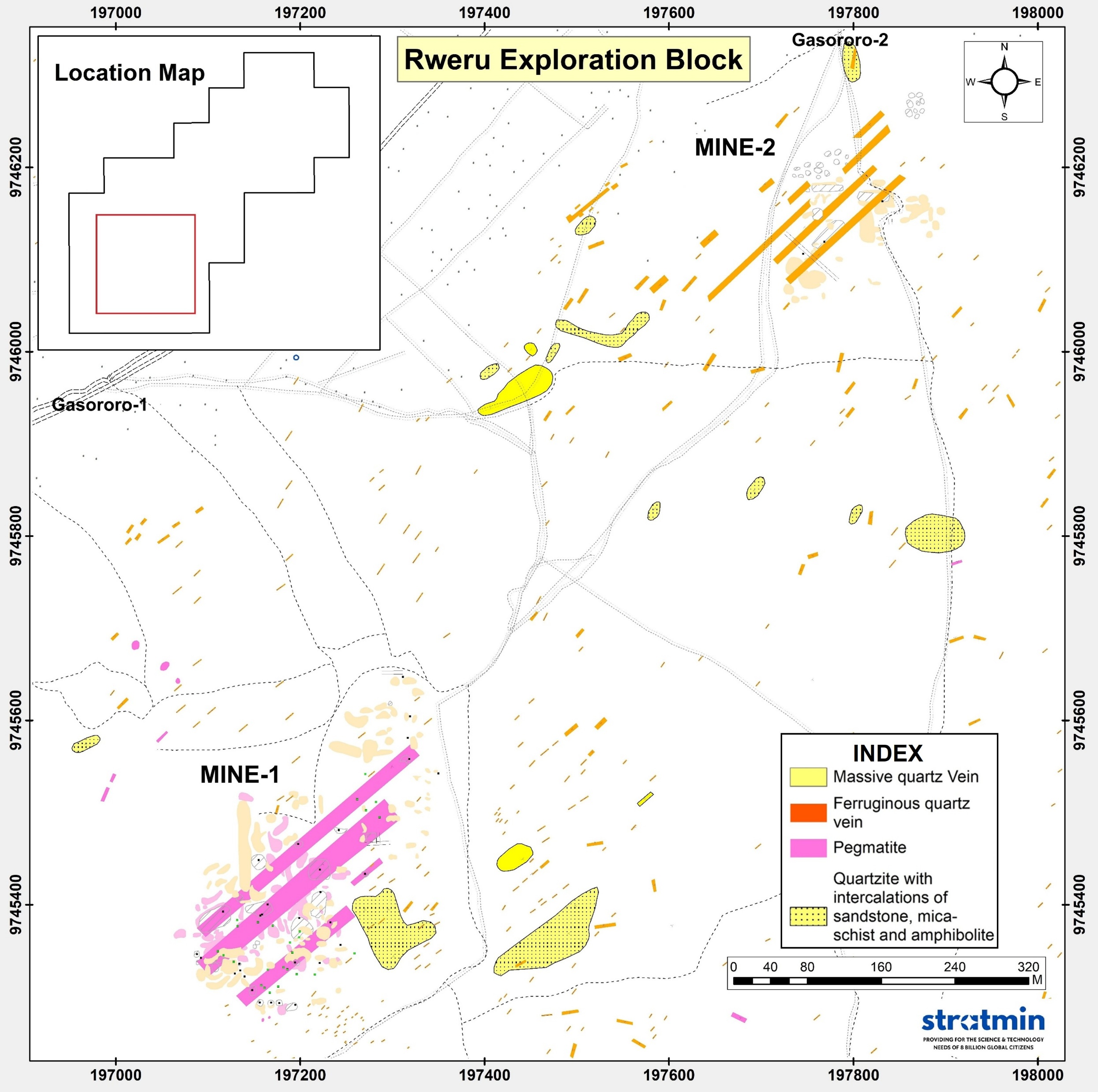
From January to March 2026, detailed geological mapping was conducted along traverse lines spaced at 10m intervals to produce a 1:1000 scale map. Field geologists systematically captured lithological, structural, and mineralization datasets using GPS and Brunton compasses.
The mapping identified distinct lithological units across the area, including crystalline and intercalated quartzite, mica-schist, amphibolite, pegmatite, ferruginous quartz veins, and massive quartz veins. There are at least 3 major NE-SW trending pegmatites parallel to sub-parallel to each other in this zone with a minimum strike length of 500m. The structural trend shows a strike direction of N40º to N55º and dip of 65º towards the east. The pegmatites show high mineralization of coltan and cassiterite.
Additionally, approximately 1.2km NE from the main mine (Mine-1), another mine (Mine-2) is present, which shows a similar structural trend but is dominated by ferruginous quartz veins and cassiterite mineralization.
Geophysical Survey & Drilling Operations
The geophysical survey was carried out in a three-phase approach combining ground magnetics, electrical resistivity tomography (ERT), and induced polarisation (IP) to map structural controls and resolve the resistivity and chargeability characteristics of priority targets. These integrated datasets support the creation of a three-dimensional model designed to differentiate between potential pegmatite bodies and other geological assemblages for the ranking and selection of drill targets.
The Rweru mining project is undertaking a drilling program consisting of a minimum of 5,000 meters of Reverse Circulation (RC) drilling and 2,000 meters of Diamond Drilling (DD) to obtain representative samples for resource evaluation and mine planning. RC & DD drilling will be engaged primarily for collecting samples at every meter and to collect bulk samples and rapid assessment of sub-surface mineralization. All drilling activities are being followed by strict protocols and international acceptable reporting standards.
Development & Future Plan
Following the completion of the drilling program and subsequent laboratory analysis of the collected samples, the data will be used for resource estimation and three-dimensional ore-body modelling. Modelling and reserve estimation software will be used to create detailed block models, generate geostatistical estimates, and visualize the spatial distribution of ore grades.
Following the completion of resource estimation and ore-body modelling, the Rweru mining project will proceed to detailed mine planning to design an efficient, safe, and economically viable extraction strategy. This will be followed by three major phases: (a) mine development, (b) production, and (c) beneficiation plant development.
Project Gallery
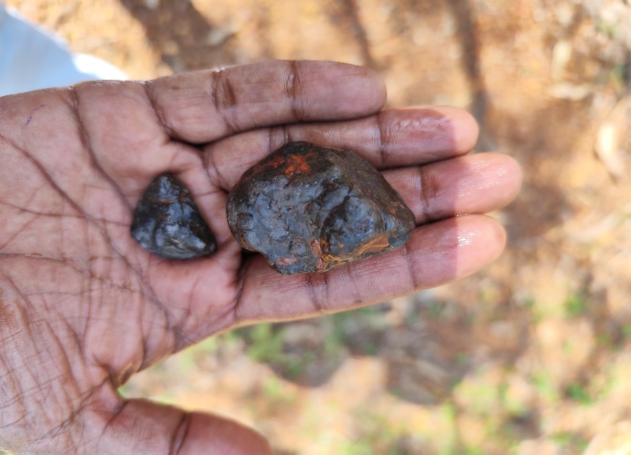
Cassiterite samples from the mine
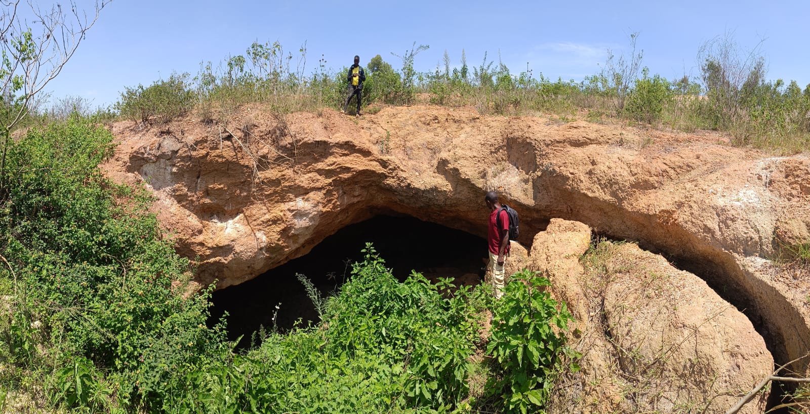
Old shaft showing weathered pegmatite
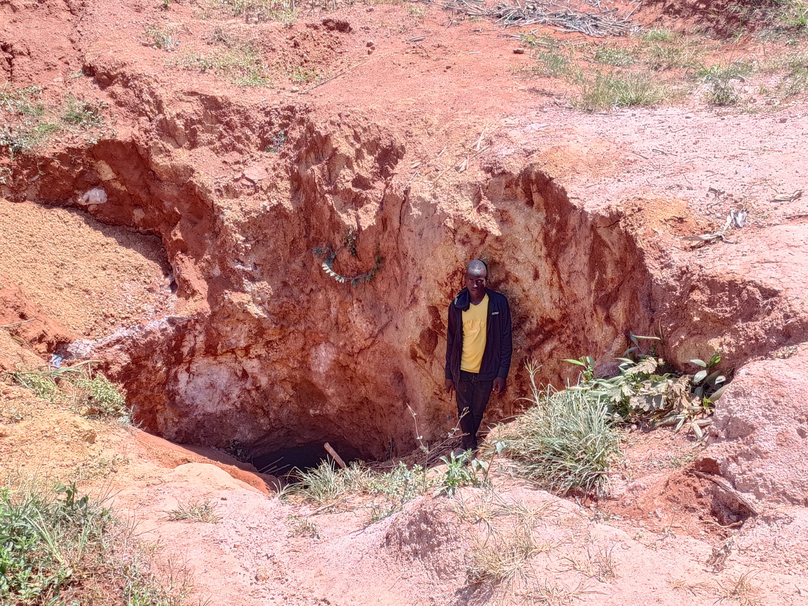
Shaft workings
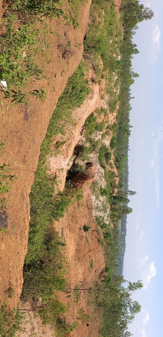
Previously excavated mining pits, trenches and dumps
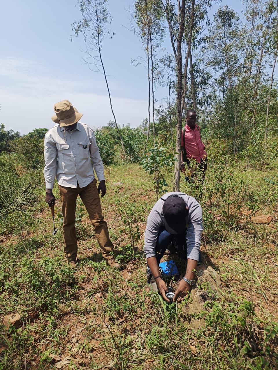
Geological Mapping Traverse
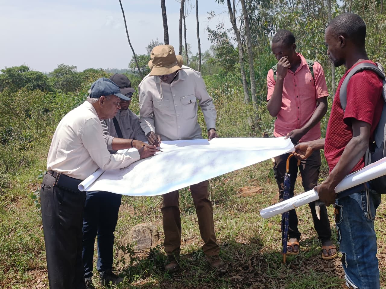
Geological Mapping in Rweru Block